It’s quite a bit more recent, but this reminded me of David Bleicher’s Instagram page “Then and Now London.” He takes photographs in the same London locations as photos taken decades ago and puts them side by side:
You can find more "then and now pictures" (rephotography) on re.photos. It has an archive of around 3000 pictures from around the world. (I developed the website as a final project during my studies. It's a bit dated but still alive and kicking.)
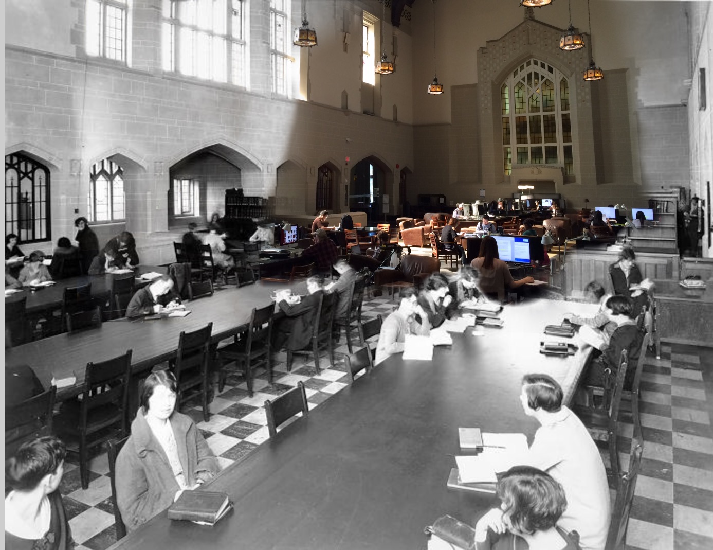
This is also sometimes known as rephotography. Some of the most striking examples I've seen seamlessly blend the old and new. Such as this campus location, which really illustrates how similar people are across time: https://blogs.ubc.ca/difficultknowledge/files/2016/09/UBCLib...
Large parts of London still look the same, but the way of life is vastly different. Just on a surface level, you can see how roads are used differently (there are a few horses and a lot of pedestrians) and with poorly insulated buildings everyone has to wear insulation.
Once you zoom into the individual maps, you can see that this is as close to Google Streetview as they could get at the time. It was surprising to realize it's basically the same thing.
looks great once you zoom in but I don't get it. how do I open one of them to look at it - I can only zoom into the whole mosaic - why can I not click on one of them and bring it to the front or go to a page that deals with that view/street?
There seems to be quite a lot of detail in all of these drawings, I wonder if one can't reconstruct an actual street view given all that data, and a few historical paintings to "seed the color and style" a bit. Probably not impossible to do with modern LLMs
If there's a map, and a sidebar with overflow, please don't have a page-level scrollbar, put the scrollbar on the sidebar that needs scroll functionality =(
https://www.instagram.com/thenandnowlondon/